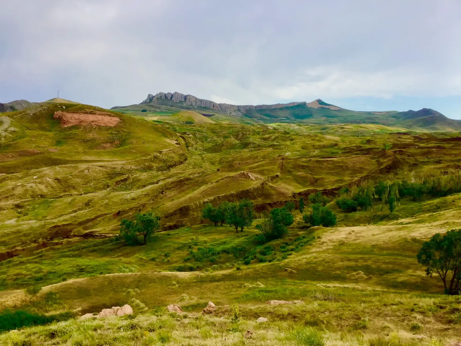
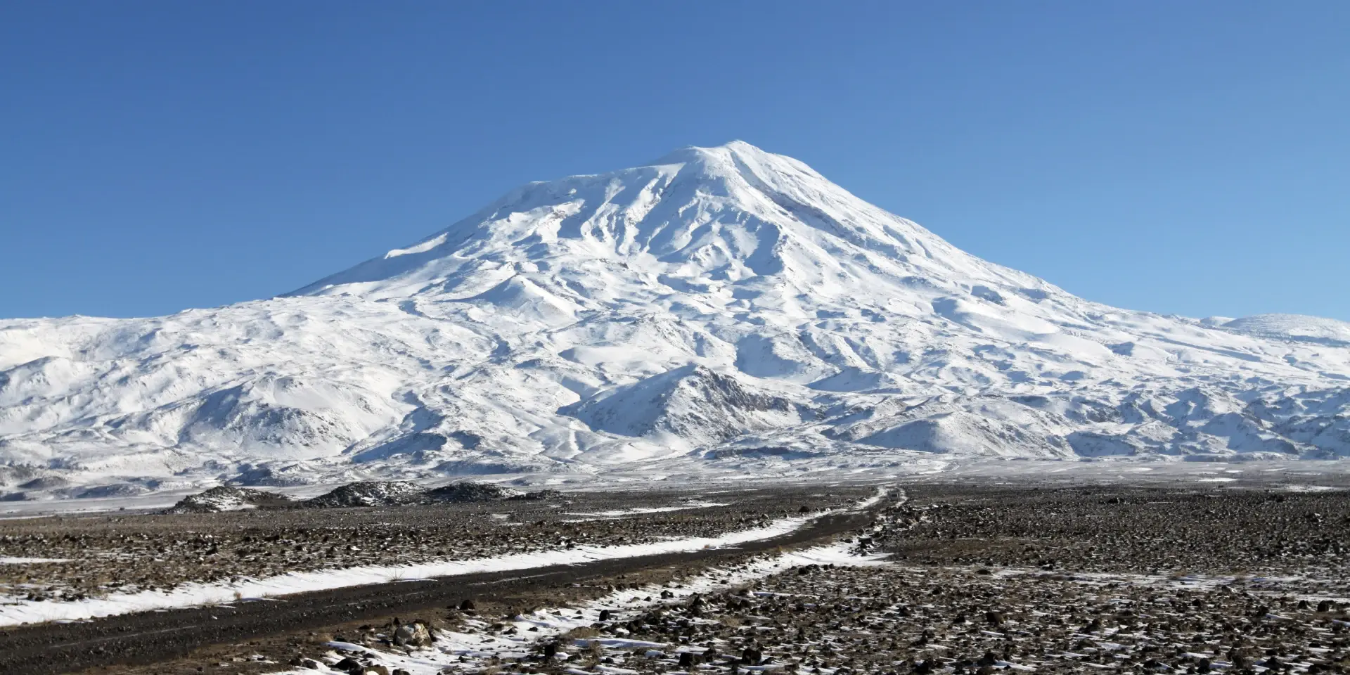
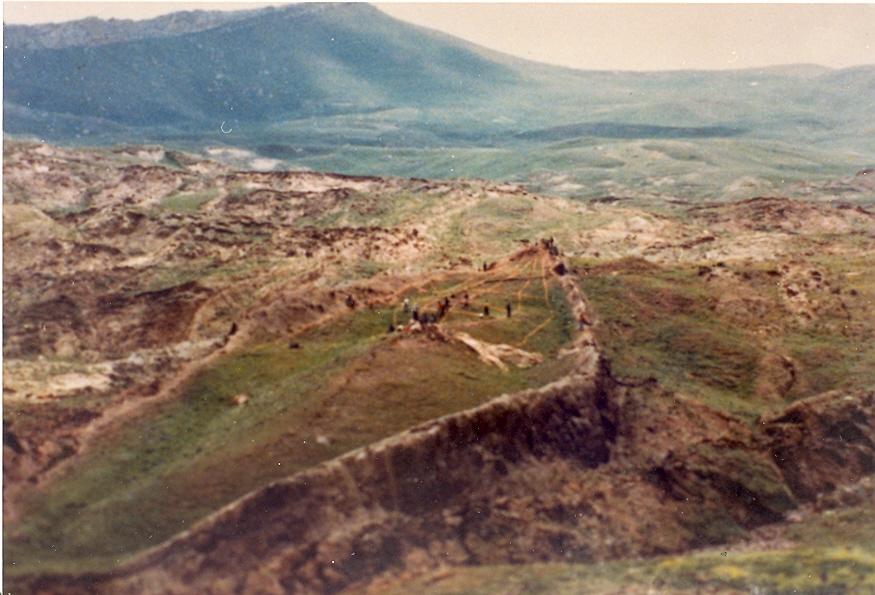
High in the Tendürek Mountains of eastern Turkey's Ağrı Province, roughly 18 miles south of Mount Ararat, there's a boat-shaped landform that has occupied a genuinely strange space in public imagination for over six decades: too geologically documented to dismiss outright as a hoax, too contested to accept as archaeological fact. In September 2026, for the first time since 1988, researchers began drilling directly into it — and the results, so far, have done less to settle the question than to sharpen exactly what's actually being asked.
Quick Digest: 2026 Durupınar Scientific Field Season
- Geographical Coordinates
- Doğubayazıt District, Ağrı Province, Eastern Anatolia, Turkey (~18 miles S of Mt. Ararat)
- Landform Dimensions
- 157 metres (515 feet) in length — roughly equivalent to 300 ancient biblical cubits
- Academic Leadership
- Prof. Dr. Cenker Atila (Dept. of Archaeology, Sivas Cumhuriyet University)
- Official Authorization
- Ministry of Environment, Urbanization & Climate Change, Republic of Türkiye
- 2026 Field Methods
- 90-day season, 1,000 soil samples across 150 sites, 3D GPR, and continuous core drilling down to 18m
- Primary Preliminary Clues
- 40% elevated internal soil carbon; pottery sherds; broken percussion drill bit at 4–5m depth
- Decisive Lab Milestone
- Early 2027 petrographic and radiocarbon testing to verify sedimentary syncline sequence
The 1959 Discovery
The story starts with an aerial photograph, not a shovel. In 1959, Turkish Army Captain İlhan Durupınar was reviewing military reconnaissance imagery when he spotted a striking, symmetrical, ship-shaped outline on a ridge above the Uzengili valley. The formation runs roughly 157 metres (515 feet) long — a figure that immediately drew comparisons to the "300 cubits" given for Noah's Ark in Genesis, since 300 ancient cubits works out to a broadly similar length, depending on which historical cubit measurement you use. The site captured global headlines almost immediately, and has remained a fixture of biblical-archaeology speculation ever since.
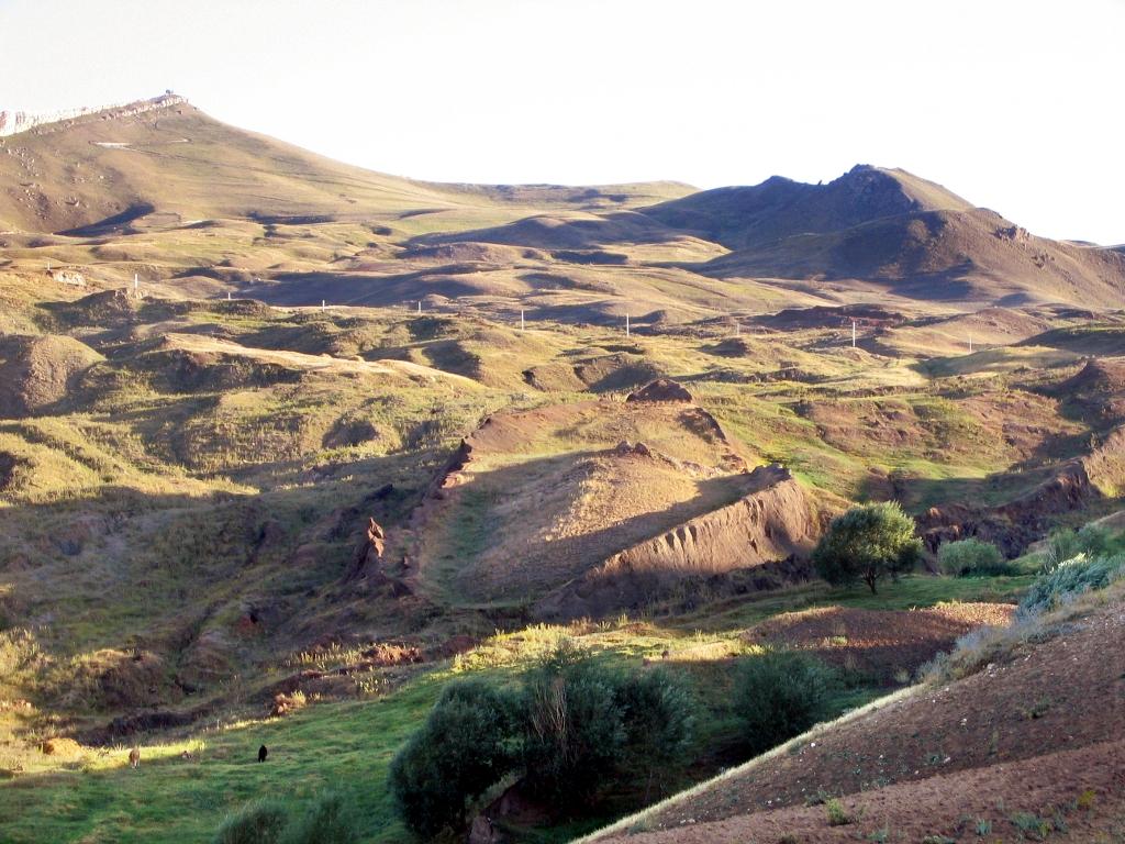
Mainstream geology, from early on, offered a more mundane explanation: a syncline — a downward fold in layered sedimentary rock, shaped over a long period by erosion and slow-moving mudflow — that happened to erode into a shape the human eye reads as a hull. It's worth noting this isn't a dismissive, hand-wavy explanation; it's a documented, specific geological classification with a name and a mechanism, not just a shrug.
What the Skeptical Case Actually Argues
Here's where the story your brief tells needs a real correction, and it's worth getting this exactly right: David Fasold wasn't simply "an early investigator who later changed his mind and called the ark theory a sham." He was the co-author, alongside geologist Lorence G. Collins, of the specific 1996 paper your brief itself cites — "Bogus 'Noah's Ark' from Turkey Exposed as a Common Geologic Structure." That's a more significant detail than it might seem: Fasold had originally been a genuine believer and promoter of the site as Noah's Ark, making him an unusually credible source for the skeptical case, since he reversed his own position based on direct field evidence rather than starting from doubt.
“I believe this may be the oldest running hoax in history. I think we have found what the ancients said was the Ark, but this structure is not Noah's Ark.”
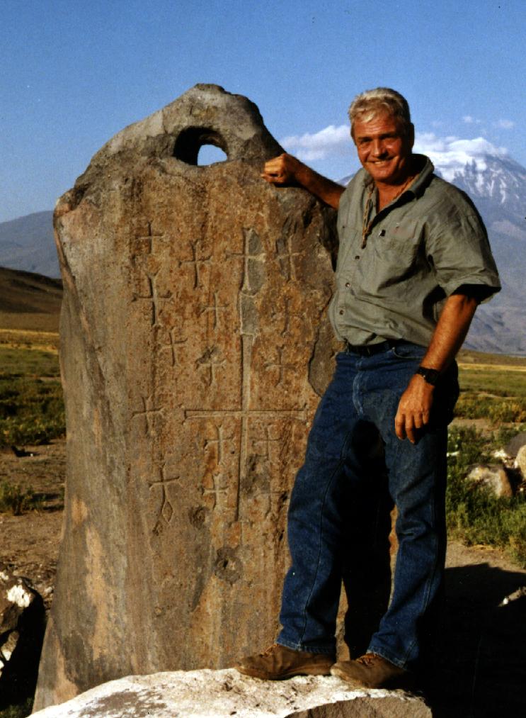
The Collins-Fasold paper, and Collins's independent follow-up work, is specific rather than merely dismissive. It identifies the formation as a "doubly plunging syncline" and works through the claimed physical evidence piece by piece: what promoters called an iron bracket, the paper argues, is weathered volcanic mineral; the supposed metal-braced walls are natural concentrations of limonite and magnetite within steeply inclined sedimentary layers; material claimed as fossilised gopherwood bark is identified as metamorphosed peridotite; and the large "anchor stones" found near the nearby town of Kazan, long cited as evidence the ark carried stone anchors from Mesopotamia, are identified as ordinary, locally sourced andesite. Separately, Turkish geologist Murat Avcı has proposed a related but distinct explanation — that the landform is part of the Telçeker earthflow, a regional landslide event, rather than Collins's syncline specifically. Fasold's own account of his reversal captures the genuine complexity of his position: after a 1994 site visit, he suggested the site may instead reflect a much older local tradition tied to a separate flood-hero figure, Ziusudra, rather than the biblical narrative specifically. Fasold has since passed away.
Dueling Hypotheses: Promoters’ Vessel Claims vs. Published Geological Science
Promoters’ Ark Claims
- Boat-Shaped Hull Outline:515-ft (300 cubit) fossilised hull of Noah’s wooden Ark preserved in mudflows
- Iron Ribs & Metal Brackets:Fossilised man-made metallic brackets and parallel structural iron joinery
- Fossilised Gopherwood Bark:Petrified timber hull planks and fossilised tree bark laminations
- Kazan Giant "Anchor Stones":Mesopotamian drogue stones dropped to stabilise the Ark during deluge waters
- Subsurface Radar Anomalies:Regular internal decks, rectangular cabins, and animal pen corridors
Peer-Reviewed Geological Reality
- Boat-Shaped Hull Outline:Doubly plunging syncline or folded resistance ridge formed by the Telçeker earthflow
- Iron Ribs & Metal Brackets:Weathered volcanic mineral concentrations of limonite and magnetite in tilted strata
- Fossilised Gopherwood Bark:Serpentinised metamorphosed peridotite and weathered sedimentary mudstones
- Kazan Giant "Anchor Stones":Locally quarried andesite monoliths, later inscribed with medieval Armenian crosses
- Subsurface Radar Anomalies:Natural cross-bedding, joint fractures, and voids typical of chaotic earthflow slip zones
What the 2026 Expedition Is Actually Doing
The current project, run under the name Noah's Ark Scans, is led in Turkey by Prof. Dr. Cenker Atila, an archaeologist in the Department of Archaeology at Sivas Cumhuriyet University, supported by the university's rector and operating under official permits from Turkish government authorities — a genuine step up in institutional legitimacy from many earlier ark-hunting expeditions, which have often been independent, faith-motivated efforts without formal academic backing.
This year's field season ran roughly 90 days, starting in late June 2026, with around 20 researchers and students from five countries. The team collected close to 1,000 soil samples from about 150 locations, conducted ground-penetrating radar (GPR) surveys, and — new for this year, and the first drilling at the site since 1988 — began direct core drilling, recovering continuous samples from depths of up to 18 metres.
What's actually been found so far, stated carefully: soil inside the formation has tested at roughly 40% higher carbon content than surrounding soil samples, which the team considers worth further investigation but does not, on its own, prove biological or organic origin tied to a vessel. Pottery fragments have been recovered at the site, though their age hasn't yet been established. During drilling, a percussion bit broke after striking a very hard layer roughly 4 to 5 metres below the surface in one borehole — the expedition has floated the possibility that this layer might be petrified wood, but this is explicitly unconfirmed, pending laboratory analysis. GPR data has also revealed subsurface anomalies that some team members and outlets have described, in preliminary and clearly speculative terms, as possible right-angle structures or cavities — language worth treating with real caution until the same data is examined independently.
Laboratory analysis of both the soil chemistry and the core samples is ongoing, with results expected in early 2027. As of now, no result from the 2026 season constitutes confirmed evidence of an ancient human-made vessel.
The Actual Test Ahead
What makes this season genuinely more interesting than prior rounds of Durupınar coverage is that it's finally testing something falsifiable. Collins's syncline explanation makes a specific, checkable prediction: continuous core samples should reveal a particular folded sequence of sedimentary rock layers. If the newly extracted cores match that predicted sequence, the syncline explanation holds. If they consistently don't, the leading skeptical account will need real revision — not dismissal, but genuine reconsideration based on physical evidence neither side had direct access to before this season's drilling.
Empirical Verification Matrix: 2026 Core Drilling vs. Classical Hypotheses
| Field Domain | Ark Promoter Hypothesis | Collins/Avcı Geological Model | 2026–2027 Core Test Criteria |
|---|---|---|---|
| Continuous Subsurface Core (up to 18m) | Laminated wooden decks, pitch sealant, and organic ballast horizons | Symmetrical, upward-curving folded sedimentary rock strata (syncline) | Thin-section petrography to identify sedimentary vs. biogenic structures |
| Internal Soil Carbon (+40% elevation) | Decayed organic timbers and animal matter from ancient ark interior | Ancient topsoil palaeosols, regional marsh peat, or natural organic shales | Total Organic Carbon (TOC) analysis and calibrated C-14 isotopic dating |
| Impenetrable Layer at 4–5m Depth | Massive silicified petrified timber balk or iron-sheathed keel structure | Dense basaltic lava lens, andesite boulder, or silicified limestone | X-ray fluorescence (XRF) and mineralogical spectrometry of drill cuttings |
| Subsurface GPR Anomalies | Geometric bulkheads, right-angled cabins, and internal rooms | Orthogonal fracture joints, tectonic shear planes, and earthflow slip voids | 3D tomographic alignment verifying whether anomalies follow natural bedding planes |
That's a meaningfully different situation than the site has been in for most of its 65-year public history, where aerial photographs, surface measurements, and dueling interpretations of the same visible rock features left plenty of room for both sides to talk past each other. Direct, continuous subsurface samples are a genuinely higher bar of evidence than anything previously available at this site.
Where This Leaves Things
The honest state of play, going into 2027, is this: the Durupınar formation remains, at minimum, a real and well-documented geological curiosity, regardless of how the ark question resolves. The skeptical case against it being Noah's Ark is not casual dismissal — it's built on named, published, specific geological findings from a researcher who once believed the opposite. The 2026 expedition is not, on the other hand, a fringe operation working entirely outside legitimate institutions — it has real university backing and official government permits, even if its funding and framing carry a clear faith-based motivation worth keeping in view. Whatever the core samples ultimately show once lab analysis concludes, this is one of the rare cases in this ongoing genre of ancient-mystery stories where an actual answer, rather than another round of dueling interpretation, is genuinely within reach — sometime in 2027, once the samples finish speaking for themselves.
Scholarly Frequently Asked Questions
What is the Durupınar formation in Turkey?▼
The Durupınar site is a 157-metre (515-foot) boat-shaped geological landform located in the Tendürek Mountains of eastern Turkey's Ağrı Province, roughly 18 miles south of Mount Ararat. Spotted in 1959 aerial reconnaissance by Turkish Army Captain İlhan Durupınar, its dimensions match the biblical description of 300 cubits for Noah's Ark, sparking over 65 years of heated archaeological and geological debate.
Did the 2026 expedition confirm the discovery of Noah's Ark?▼
No. The 2026 expedition led by Prof. Dr. Cenker Atila of Sivas Cumhuriyet University drilled continuous core samples down to 18 metres and collected nearly 1,000 soil samples. While the team detected roughly 40% higher carbon inside the formation and broke a percussion drill bit on a very hard layer at 4–5 metres depth, no result constitutes confirmed evidence of a human-made vessel. All core and soil samples remain under laboratory analysis with findings expected in early 2027.
Why did researcher David Fasold reverse his belief about Noah's Ark?▼
David Fasold was originally a prominent advocate who promoted Durupınar as Noah's Ark. However, after extensive fieldwork and petrographic testing, he co-authored a landmark 1996 paper with geologist Dr. Lorence G. Collins titled "Bogus 'Noah's Ark' from Turkey Exposed as a Common Geologic Structure." They demonstrated that claimed iron brackets and metal walls were natural limonite and magnetite concentrations, claimed fossilised bark was metamorphosed peridotite, and claimed anchor stones were ordinary local andesite.
What is the primary geological explanation for the boat-shaped structure?▼
Mainstream geologists classify the site as a doubly plunging syncline — a downward fold in layered sedimentary rock eroded by water and earthflow into a boat-like shape — or an erosion-resistant pressure ridge formed within the regional Telçeker earthflow landslide.
How is the 2026 drilling providing a falsifiable scientific test?▼
Dr. Collins's syncline model makes a specific, checkable prediction: continuous subsurface core samples should reveal a distinct upward-curving folded sequence of sedimentary rock layers. If the newly extracted cores match that sequence, the natural syncline explanation holds. If they diverge, the leading skeptical account will require genuine scientific revision based on empirical subsurface evidence.
Explore Related Archaeological & Earth Science Investigations

Aakash Bhagat
Founder & Editor
Independent writer and researcher covering Indian history, culture, technology and current affairs.
Uncovering Indian Thought & Discoveries
Join historians, researchers, and curious minds. Delivered every Sunday morning—no algorithms, no spam, pure scholarship.