Lothal: The Harappan Port That Harnessed the Tides
More than four thousand years ago on the Gujarat coast, Harappan engineers built a massive brick basin that connected urban craft workshops to the tidal waters of the Gulf of Khambhat.
At Lothal, archaeologists uncovered a massive 217-metre brick basin, inlet and outlet sluices, a 240-metre cargo wharf, and bead factories. Discover how this Bronze Age port town harnessed the extreme tides of the Gulf of Khambhat to power maritime trade with the Persian Gulf and Mesopotamia.
Aakash Bhagat
Founder & Editor
•Updated September 9, 2026•12 min read
Excavated trapezoidal burnt-brick basin and cargo wharves of the Harappan maritime complex at Lothal, Gujarat.Archaeological Archives
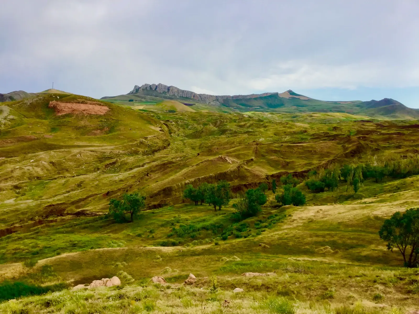
High in eastern Turkey’s Tendürek Mountains, a 515-foot boat-shaped formation has puzzled researchers for 65 years. In September 2026, university archaeologists began direct core drilling for the first time since 1988. Discover what was actually recovered, how Collins and Fasold exposed early claims, and the falsifiable test awaiting 2027 lab results.
Atop the sacred Sivagiri hill in Palani, Tamil Nadu, stands an ancient idol crafted not from stone or bronze, but from Navapashanam—an alchemical matrix of nine deadly poisons solidified by Sage Bogar. Discover the hidden chemistry, the healing powers of the overnight sandal paste and abhishekam prasadam, the subterranean tunnel connecting Bogar's samadhi, and the controversial 2004 replacement that triggered an international antiquities investigation.
Coorg's hillside resorts book out months in advance now. Gokarna's main beach can feel more like a queue than a shoreline, and Hampi comes with tour buses in equal measure. But Karnataka's Malnad hill country and coastal belt hold a genuinely different kind of trip: rainforest instead of resort, empty tide lines instead of beach shacks, and moss-draped forts you'll have mostly to yourself. Discover 7 secret places in Karnataka that redefine South Indian travel.
Whether you crave snowy Himalayan walks, candlelit palace reflections across Lake Pichola, high-energy beach parties in Goa, colonial carnival effigies in Fort Kochi, or tropical isolation in the Andamans, India offers an astonishing spectrum of year-end celebrations. Discover five magical destinations to spend Christmas and New Year.
More than four thousand years ago, on the coast of what is now Gujarat, an urban settlement developed around a remarkable piece of hydraulic architecture.
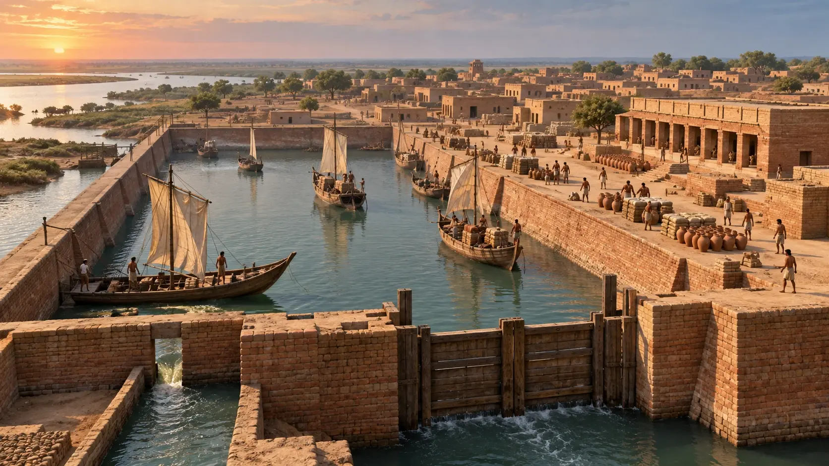
At Lothal, archaeologists uncovered a massive brick-lined basin measuring roughly 215–217 metres in length and approximately 35–37 metres across. Its walls, channels, inlet and outlet arrangements have long been interpreted as the remains of an ancient dockyard connected to the tidal waters of the Gulf of Khambhat.
If that interpretation is correct—and substantial archaeological evidence supports it—Lothal represents one of the most remarkable examples of maritime engineering from the Bronze Age.
Lothal and the Harappan World
Lothal flourished during the mature phases of the Harappan civilisation, with UNESCO's tentative-list documentation placing the site's occupation broadly between 2400 and 1600 BCE. The settlement was located in present-day Gujarat, near the village of Saragwala, at the head of the Gulf of Khambhat.
Its ancient geographical setting was considerably different from the modern landscape. The settlement was associated with the Bhogava River, a tributary of the Sabarmati system, and tidal waters from the Gulf could reach the area through an ancient channel. Over time, changes in the river and the accumulation of sediment altered this environment.
This location was crucial: for a Bronze Age trading settlement, access to both inland waterways and the sea offered enormous economic advantages. Goods could move between the settlement, river routes and the Gulf. That geographical position helps explain why Lothal developed into both a manufacturing centre and a proposed port town.
The Discovery of Lothal
Lothal came to archaeological attention during a systematic survey of Gujarat in 1954. The excavations that followed were conducted under the direction of archaeologist S. R. Rao, and continued through subsequent seasons, revealing an upper citadel, a lower town, organized streets and drainage, industrial workshops, a large warehouse, bead-making facilities, and the enormous brick-lined basin.
The Great Basin: Lothal's Most Famous Structure
The most striking feature of the site is the enormous trapezoidal basin on the eastern side of the settlement. Its dimensions are given slightly differently in various archaeological descriptions, but a reasonable summary is approximately: **215–217 metres long × 35–37 metres wide**.
The basin was constructed with burnt bricks, while the surrounding embankments included mud-brick construction. UNESCO's tentative World Heritage documentation identifies the basin as approximately 217 metres long and 26 metres wide, illustrating why exact dimensions should be treated cautiously depending on the portion and method of measurement being considered. What matters more than the last few metres is its scale: this was an enormous engineered water enclosure built within an urban settlement.
Kiln-burnt ceramic bricks bound with water-resistant gypsum mortar
Tidal Fluvial Inlets
Northern and eastern inlet channels connecting to the ancient Bhogava/Sabarmati
Sluice & Spillway Control
Southern spill channel with vertical grooves for a sliding wooden gate
Mudbrick Wharf Platform
Over 240 metres long along the western edge for cargo handling
Adjoining Warehouse
Monumental 64-block podium structure preserving terracotta seal impressions
Was Lothal Really a Dockyard? The Archaeological Evidence
The basin has traditionally been interpreted as a tidal dockyard, beginning with the work of S. R. Rao and subsequent archaeological investigations. Researchers identified inlet channels, an outlet or spill channel, a sluice arrangement, a long platform interpreted as a wharf, a nearby warehouse, marine organisms, stone anchors, marine shells, and the site's connection with an ancient river channel leading toward the Gulf.
Marine archaeological research also identified foraminifera and other marine organisms within sediments associated with the basin, providing evidence of a marginal marine environment. These findings make the dockyard interpretation compelling.
How Did the Tidal System Work?
If the basin was a dockyard, its location created an interesting engineering opportunity. The Gulf of Khambhat is known for its exceptionally large tidal range. At high tide, water could move through channels connecting the basin to the surrounding riverine and tidal environment.
The basic principle was simple but sophisticated: **High tide → water enters the basin → boats enter → water is retained → cargo can be handled → controlled release allows water levels to change.**
The archaeological structure included inlet and outlet arrangements that have been interpreted as mechanisms for controlling the water level. UNESCO specifically describes an inlet and outlet at opposite ends of the basin that would have helped maintain sufficient water for boats. An archaeological study of Harappan hydraulic engineering describes northern and eastern inlets and a southern spill channel with a sluice gate, allowing excess water to be discharged and water levels to be regulated.
The Sluice Gate and Spillway
One of the most fascinating details is the proposed sluice mechanism. Archaeologists identified vertical grooves and structural arrangements in the basin's brickwork that have been interpreted as accommodating a wooden gate. The gate itself has not survived as an intact wooden artifact. Therefore, it is better to say that the architecture indicates the probable use of a wooden sluice gate.
The engineering principle would have been familiar to anyone who understands modern hydraulic systems: *Control the opening → control the flow → control the water level.* A 1958–59 archaeological report also recorded a wooden-door-style sluice arrangement in another Lothal drainage context, demonstrating that the settlement's builders understood sliding wooden barriers as part of water management.
The basin also contained a spill channel. Its purpose is generally interpreted as controlling excess water entering the basin during high tides. Without some form of controlled outlet, unusually high water levels could threaten the basin's walls and the surrounding settlement. The spillway demonstrates that the engineers had to answer the equally important question: *How do we get excess water out?*
Brick, Mortar and Water Management
Lothal's hydraulic architecture depended heavily on carefully constructed brickwork. Burnt bricks were used in the basin walls, while mud-brick embankments formed broader structural elements. Some descriptions associate the burnt-brick masonry with gypsum mortar, a material also encountered in other Harappan hydraulic structures.
However, it would be an exaggeration to call the entire structure “completely waterproof.” Ancient hydraulic construction does not need to be perfectly waterproof to function. The goal is to create a controlled water-retaining environment with sufficiently stable walls and manageable seepage. The combination of burnt brick + embankments + channels + controlled openings was far more important than any single waterproofing material.
The Wharf and Warehouse: Commercial Integration
A long platform ran alongside the basin. Archaeological interpretations have identified this structure as a wharf, potentially providing space for loading and unloading goods. Excavations recorded a mud-brick platform more than 240 metres long along the western side of the basin.
A port is not simply a place where boats float; it needs infrastructure for arrival → berthing → loading → unloading → storage → distribution. The combination of the basin, wharf and nearby warehouse makes Lothal look less like an isolated water tank and more like an integrated commercial installation.
Near the dock stood a large structure interpreted as a warehouse. UNESCO describes a substantial building within the upper town whose walls preserved impressions of sealings that may have been associated with goods awaiting export. Goods did not simply arrive at the waterfront—they were inspected, stored, marked with clay sealings, and redistributed.
Lothal as a Manufacturing Centre: Beads and Metallurgy
Lothal was not merely a port; it was also an important craft-production centre. Archaeological excavations revealed evidence of bead manufacture involving semi-precious stones, copper working, and pottery production. UNESCO specifically identifies a bead-making industry within the lower town.
Among the materials associated with Lothal's craft traditions were stones such as carnelian and agate. Transforming raw stone into standardized, polished micro-beads required considerable skill across five distinct stages: selection → cutting → shaping → drilling → polishing. The dock did not exist in isolation; it was the maritime export wing of an integrated industrial economy.
Evidence of Long-Distance Trade: Persian Gulf and Mesopotamia
The strongest evidence for Lothal's participation in long-distance trade comes from the combination of its location, manufactured goods, seals, sealings, marine objects and connections with the wider Harappan trading world. UNESCO identifies artifacts at Lothal whose origins can be traced to the Persian Gulf and Mesopotamia.
Mesopotamian cuneiform sources refer to a maritime trading partner called **Meluhha**, widely associated by scholars with the Indus civilisation. Mesopotamian archaeological collections contain objects demonstrating contact with the Indus world, including etched carnelian beads and Indus-style stamp seals. The British Museum notes Mesopotamian evidence for ships from Meluhha and the presence of Indus-related seals in the Gulf region.
Lothal and the Persian Gulf Network
The Persian Gulf was particularly important to Harappan maritime exchange. In 1963, S. R. Rao published the discovery of a circular “Persian Gulf”-style steatite seal at Lothal—a seal type characteristic of Dilmun (modern Bahrain). UNESCO specifically notes Persian Gulf seals, marine shells and other evidence associated with Lothal's maritime interpretation, confirming that the Gulf served as a vital maritime corridor linking South Asia with the ancient Near East.
Was Lothal an “Ocean-Faring” City?
The phrase needs qualification. It is reasonable to say that Lothal was connected to maritime trade and that boats could navigate through its tidal and riverine environment. Archaeological evidence includes stone anchors and marine shells, while the basin's hydraulic design facilitated the movement and berthing of boats.
However, we should be cautious about imagining enormous ocean-going ships comparable to later historical vessels. Some archaeological interpretations suggest that the dock accommodated relatively modest vessels suitable for coastal and riverine navigation (such as vessels approximately 18–20 metres long). The Harappans were maritime traders, but portraying every Lothal vessel as a deep-ocean galleon is anachronistic.
The Problem of Silt and Changing Rivers
Lothal's greatest geographical advantage eventually became one of its greatest problems. The Gulf of Khambhat and its associated river systems are highly dynamic environments where sediment accumulates rapidly in shallow waterways. Archaeological evidence indicates that the ancient river channels changed and that the port eventually became increasingly difficult to operate. UNESCO notes evidence of flooding and silting that contributed to the site's eventual decline.
The Real Engineering Achievement
It is tempting to describe Lothal simply as an “ancient tidal dock.” But the real achievement was more complex. The builders needed to create a large basin that could receive water, retain water, accommodate boats, support cargo handling, release excess water, and survive repeated tidal cycles in a landscape vulnerable to flooding and sedimentation.
Rigorous Archaeology vs. Popular Exaggerations
Defensible Archaeological Record
Basin Function:Engineered tidal basin widely interpreted as a dockyard with sluice and wharf infrastructure.
Vessel Sizes:Coastal and riverine trading boats roughly 18–20m in length using stone anchors.
Trade Partners:Firmly documented trade with the Persian Gulf (Dilmun), Oman, and Mesopotamia (Meluhha trade).
Sluice Mechanism:Brick grooves indicating the probable insertion and operation of sliding wooden gates.
Popular Misconceptions
Basin Function:Claiming the dockyard identification is absolute, closed fact without acknowledging alternative reservoir theories.
Vessel Sizes:Imagining deep-sea transatlantic-style wooden galleons docking at the site.
Trade Partners:Asserting direct state-to-state maritime trade routes with ancient Egypt.
Sluice Mechanism:Claiming excavators uncovered an intact, working 4,000-year-old wooden mechanism.
Chronology of Lothal & Maritime Excavation
c. 2400–1900 BCE
Mature Harappan Phase (Phase A)
Construction of the burnt-brick basin, warehouse podium, 240m wharf, bead workshops, and flourishing maritime trade with the Persian Gulf and Mesopotamia.
c. 1900–1600 BCE
Late Harappan Phase (Phase B)
Shifting river channels, heavy silt deposition, and major flooding lead to a decline in dockyard accessibility and urban contraction.
1954 CE
Discovery by Archaeological Survey of India
ASI team surveys Saurashtra and identifies the ancient mound near Saragwala at the head of the Gulf of Khambhat.
1955–1960 CE
S. R. Rao’s Comprehensive Excavations
Systematic clearance uncovers the 217m brick basin, sluice grooves, warehouse sealings, and the Persian Gulf circular steatite seal.
2014–Present
UNESCO Tentative Listing & Geomorphic Research
Lothal is submitted to the UNESCO World Heritage tentative list; modern satellite and micropaleontological studies confirm marine foraminifera and ancient river conduits.
Conclusion: Lothal's Greatest Legacy
Lothal does not need to be called a “lost ancient super-port” to be extraordinary. The archaeological evidence is enough. More than four thousand years ago, Harappan builders created a large brick-lined basin in a landscape influenced by rivers, tides and sediment. They connected it to waterways, created controlled inlet and outlet arrangements, constructed infrastructure for handling goods and established workshops capable of producing valuable craft products.
“The Harappans were not merely builders of cities. At Lothal, they were builders of connections—between river and sea, workshop and warehouse, local production and distant markets.”
Beyond Bharat Editorial Team — Maritime Heritage of the Indus World
Some details of the basin's function remain debated. That uncertainty is not a weakness; it is part of archaeology. The most responsible conclusion is that Lothal provides compelling evidence for the maritime and industrial capabilities of the Harappan civilisation, while its great basin remains one of the earliest and most intriguing examples of large-scale hydraulic architecture associated with maritime activity.
Scholarly Frequently Asked Questions
Was Lothal definitely the world’s first tidal dockyard?▼
Lothal is widely recognized as one of the world's earliest large engineered basins interpreted as a tidal dock. While S. R. Rao's dockyard theory is supported by marine foraminifera microfossils, stone anchors, and sluice grooves, some scholars have suggested alternative interpretations such as an irrigation reservoir. Thus, it is most accurately described as one of the earliest engineered basins widely interpreted as a tidal dockyard.
How did the tidal dock at Lothal operate?▼
The Gulf of Khambhat experiences some of the highest tidal ranges in the world. At high tide, water flowed through an inlet channel into the 217-metre brick basin, allowing cargo boats to enter. A wooden sluice gate accommodated in vertical wall grooves retained water during low tide so boats remained afloat, while a southern spillway allowed excess water and silt to be discharged.
Did Lothal trade with Egypt and Mesopotamia?▼
Lothal was actively engaged in trade with the Persian Gulf (Dilmun / Bahrain) and Mesopotamia (where Indus goods were associated with Meluhha). Archaeological evidence includes circular Persian Gulf steatite seals, etched carnelian beads, and copper ingots. However, claims of direct maritime trade between Lothal and ancient Egypt are not supported by archaeological evidence.
Why did the port of Lothal decline?▼
Lothal was vulnerable to the dynamic fluvial and tidal geomorphology of the Gulf of Khambhat. Repeated floods and heavy silt deposition choked the inlet channels, while the Bhogava and Sabarmati rivers gradually shifted courses away from the settlement, cutting the basin off from reliable tidal navigation.